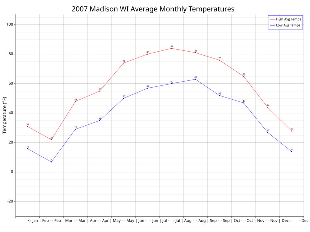
The data for the capital cities of all 50 states and Washington DC were captured for as far back as data are available. The oldest data go back to the 1870’s (Washington DC, Santa Fe NM, Sacramento CA) but a few capitals only go back to the 1930’s (Columbia SC, Pierre SD).
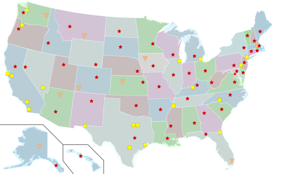
Each red star represents that state’s capital and is shown approximately where the city is located in its state. The data sets that were selected were as close to the downtown area of each capital as could be located.
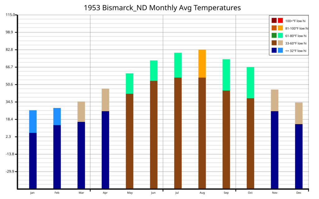
The following charts are available:
Top 4000 Temps

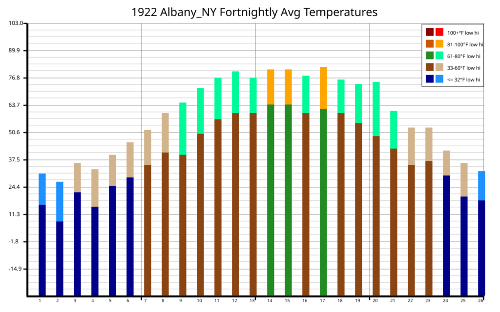
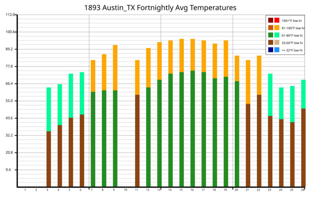
Bar Charts
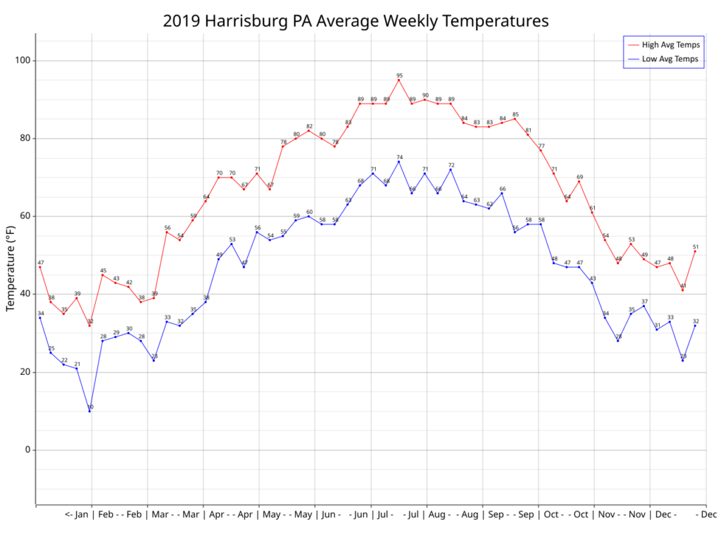
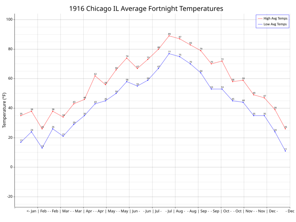
Line Charts
Compare Decades
Compare Date
Compare Cities
Videos